Project At-a-Glance
- A Design-Bid-Build project with Construction Manager at Risk
- Brierley Associates provided final detailed design of the main Phase 1 retention system
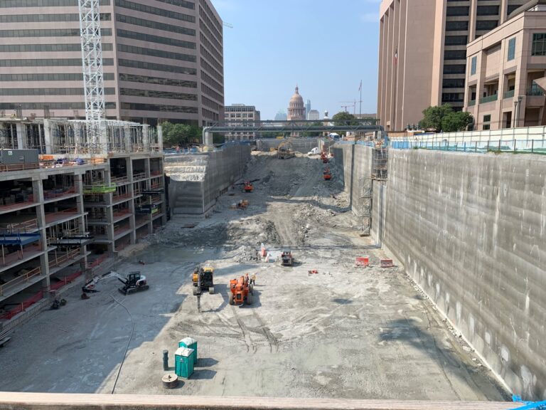
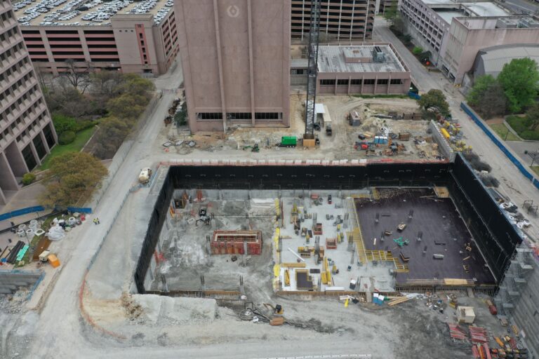
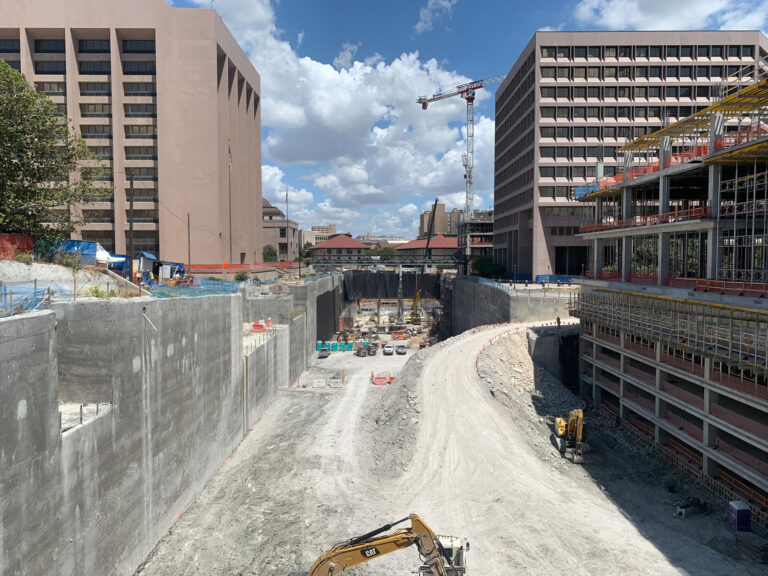
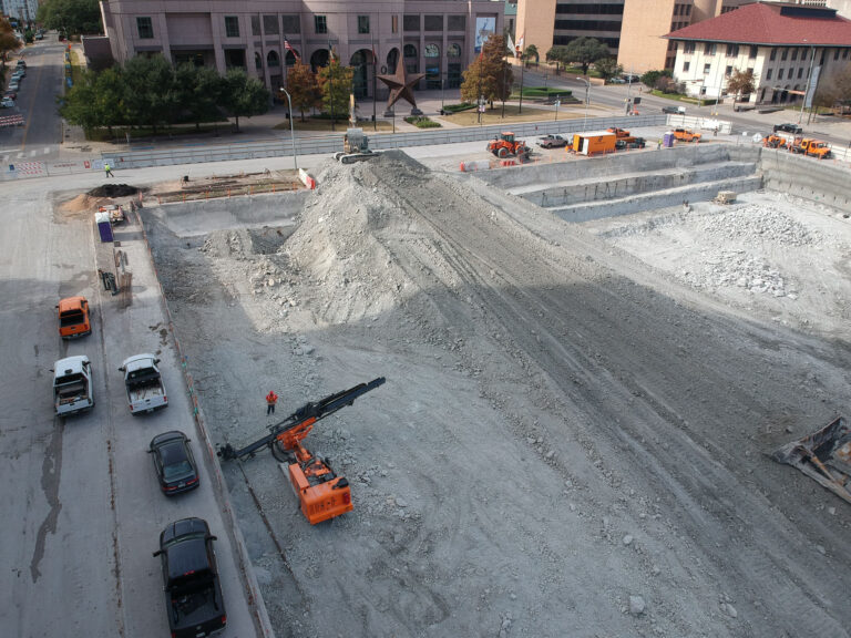
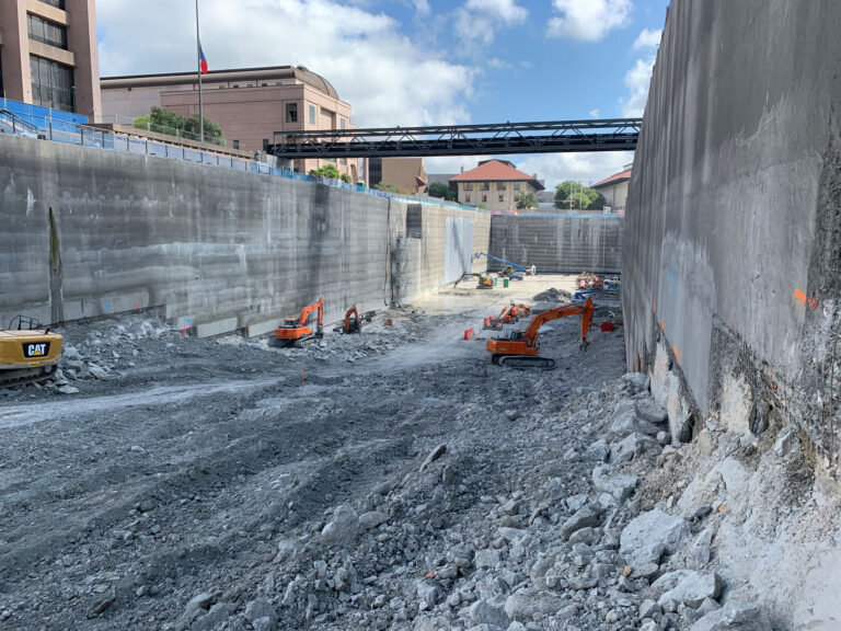
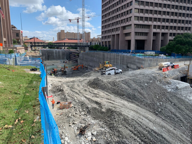
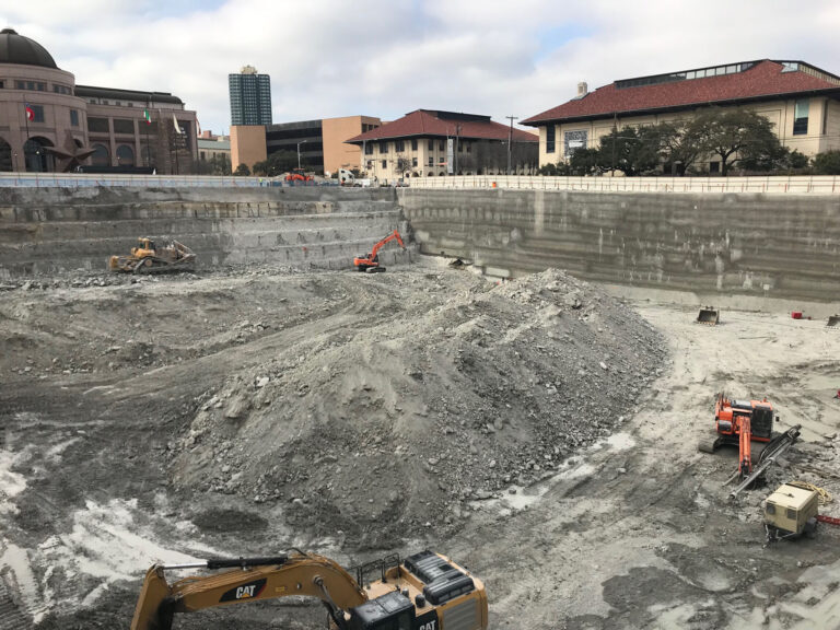
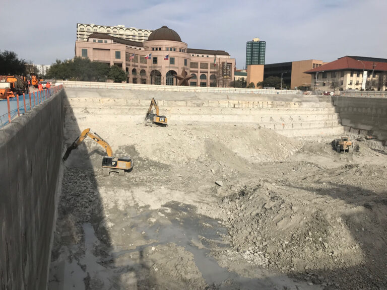
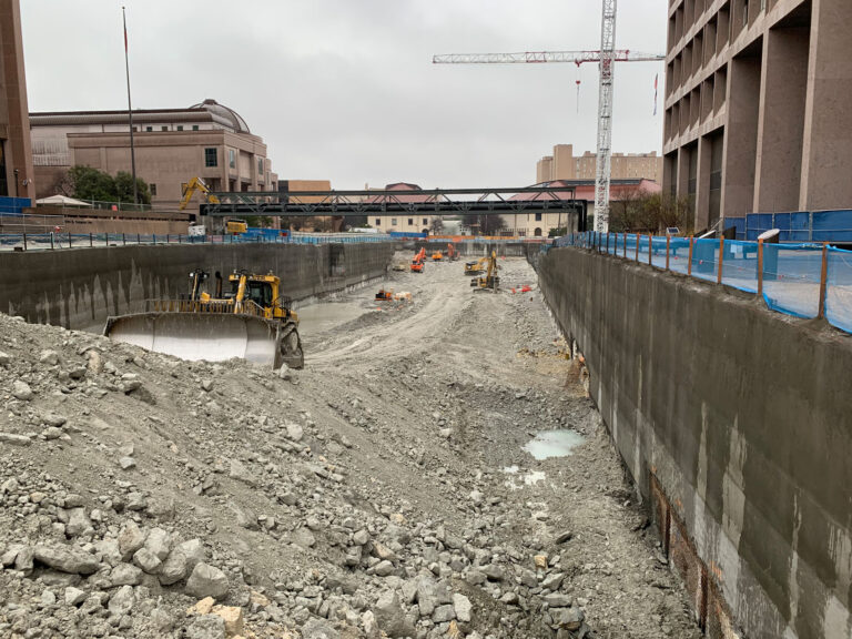
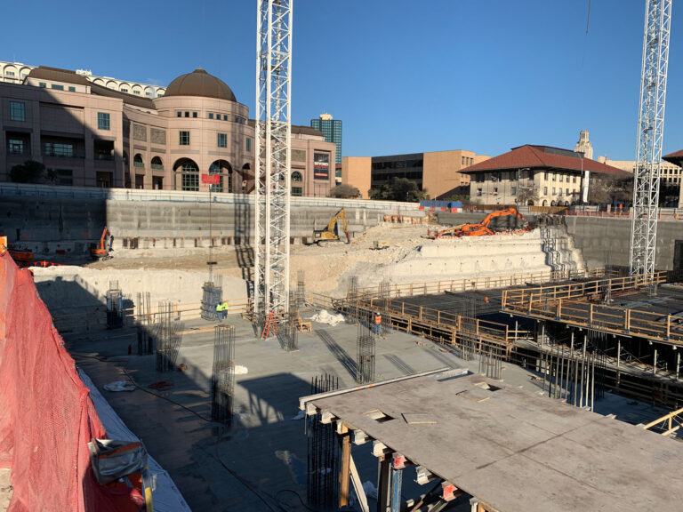
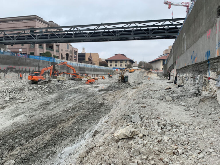
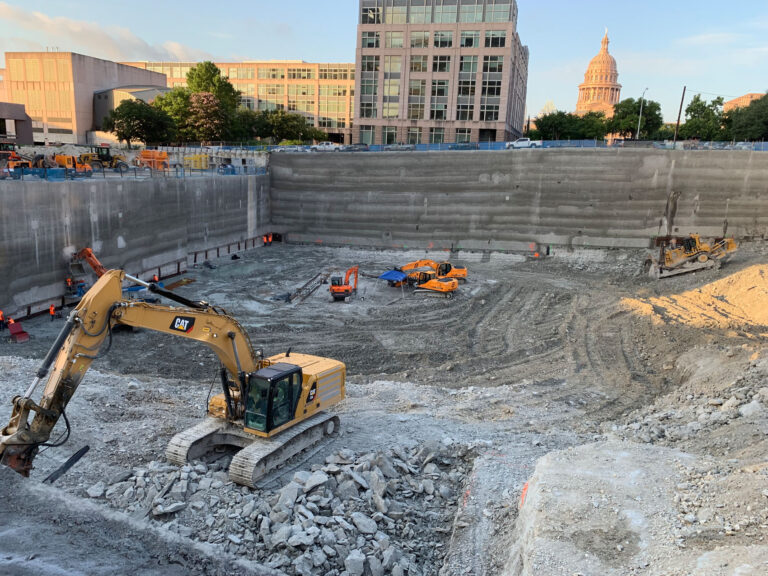
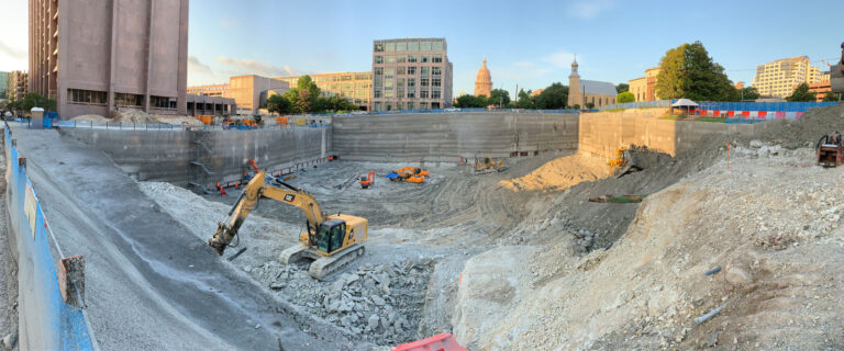
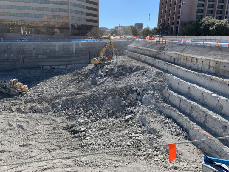
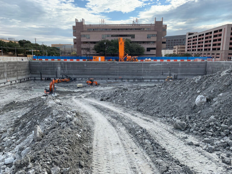
- 3-block, ~65-ft deep, 500,000+ CY Excavation through overburden and limestone bedrock
- Extensive support of excavation program in an urban setting with numerous adjacent buildings
- Design and construction of a Temporary Relocated Utility Support Structure (TRUSS) spanning over the excavation to maintain existing utilities in service during construction.
Recognition
- Learn more about this project and see photos and video of the progress at the Texas Capitol Complex Project Page
Project Narrative
The State of Texas adopted a master plan to reimagine and expand the existing Capitol Complex in Austin while reducing the cost to the state for leased office space. Phase 1 of this expansion will add two new State office buildings and five levels of underground parking to the existing Complex. Additionally, a landscaped pedestrian mall will be built atop the 5-level underground parking structure and serve as the entrance to the museum district.
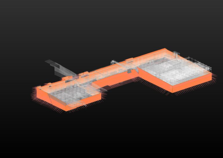
Brierley Associates was selected to provide final detailed design of the main Phase 1 retention system, an approximately 40-to 65-ft deep, 500,000+ CY excavation through overburden and limestone bedrock. As the project is within a dense urban setting, significant coordination with adjacent major structures and utilities was required, which necessitated modeling the entire retention system design with Revit.
Our system design utilizes soil nails, soldier piling with tiebacks and rock anchors with a shotcrete facing for blindside waterproofing. Due to the expansive nature of this project, a significant number of utilities had to be temporarily routed on a 150-ft span truss structure over the excavation, Brierley Associates provided the structural design for this utility support structure, which required extensive coordination with the excavation support and underground utilities.
As part of the construction phase, Brierley Associates provided field mapping of the exposed excavation face to identify geologic features with adverse characteristics outside the retention system basis of design parameters. Any required modifications were addressed based on this detailed understanding of generally localized conditions, with field directives issued on a near real time basis to minimize disruption to the overall construction schedule.
The Owner’s project requirements dictated that all permanent structures be designed within BIM (Revit-based) platforms. Although temporary, as the retention system defined the limits of the structure and would potentially conflict with existing site infrastructure, this was also modeled in Revit, with live models shared via an Egnyte server. Similarly, the TRUSS foundations, abutments and superstructure were included in this model for coordination with the retention system components and underground utilities. The Revit model further provided an automated means to develop anchor schedules and manage the procurement of required materials, including the approximately 90,000 linear feet (27,400 m) of anchor tendons required. Including the excavation support system in the BIM model also facilitated coordination with the ongoing permanent civil and structural design development and addressing updates to the retention system as overall design progressed from concept to final.